Whirr, whirr, whirr.
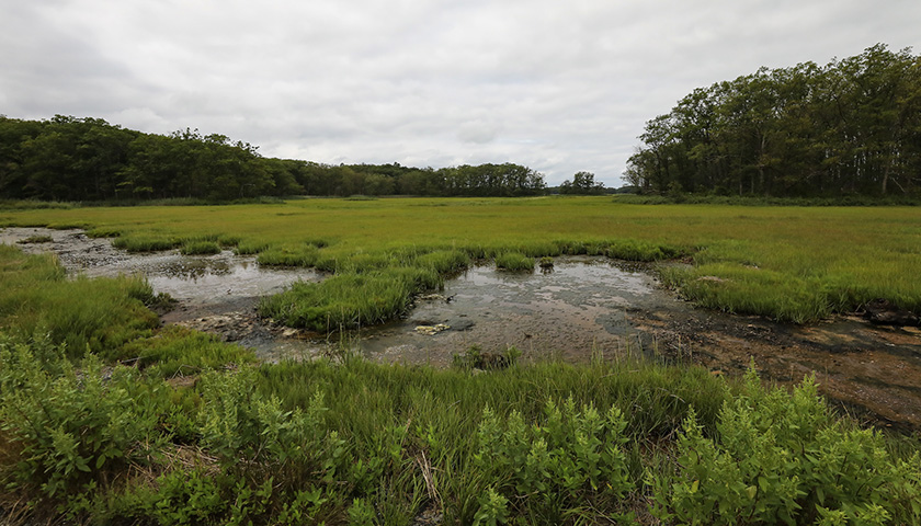
A camera-equipped drone rises above the salt marsh and begins flying a pattern: long straightaway, abrupt turn, parallel straightaway.
Drones can be used as toys and for research. They are the tools of photographers, storm trackers, the military, and, perhaps soon, package-delivery services. But in the hands of Suffolk University scientists and students, drones are being used to study climate change.
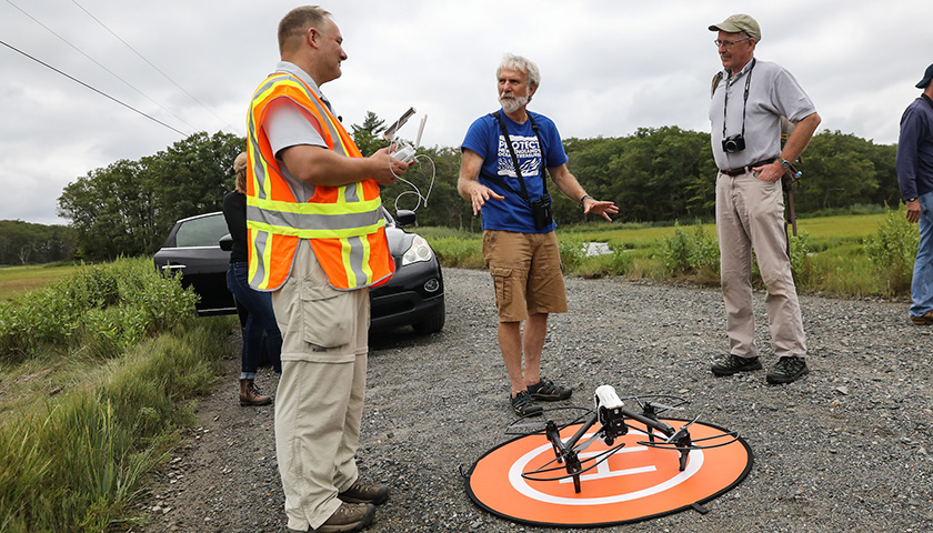
“We’re finding ways to use the drone to do good,” says Scott Lussier, practitioner in residence for Suffolk’s Center for Urban Ecology & Sustainability (CUES) and a licensed drone pilot.
Vegetative foreboding
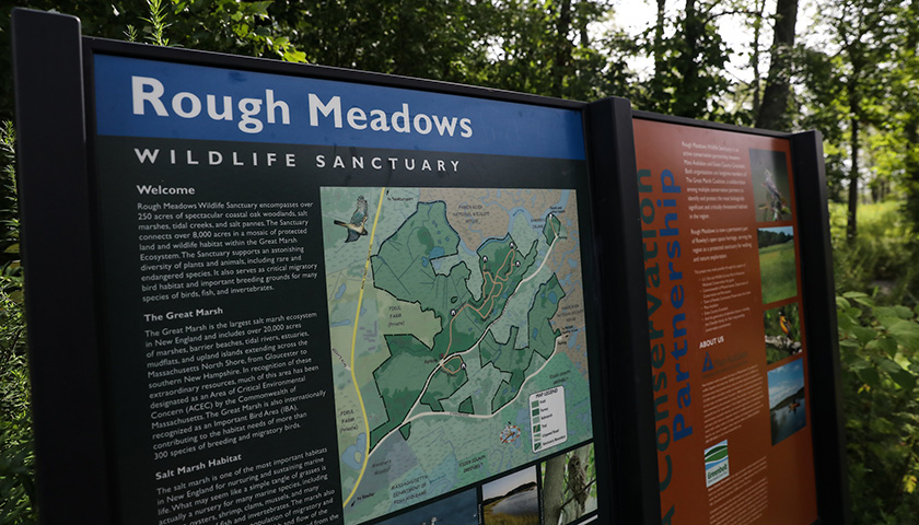
He and Biology Professor Peter Burn have partnered with Massachusetts Audubon Society scientist Robert Buchsbaum to document sea-rise-related changes in the Audubon’s Rough Meadows Sanctuary near Plum Island and to determine how drones are best used in that effort.
Photos shot from a drone can be used to identify plant species in the salt marsh, to monitor how they are changing, and to learn what that says about climate change.
“Salt marshes are really the canary in the coal mine,” says Burn, who began studying the marshes in the 1970s.
“What’s happening in the salt marsh is only the tip of the iceberg. There shouldn’t be any debate about sea level change, but we’re providing the evidence. It’s going to change the marsh, but it’s also going to change Boston.”
Pilot projects
Lussier offers an “Introduction to Drones” class that includes hands-on experience and prepares students for the Federal Aviation Administration's Unmanned Aerial Vehicle Airmen exam. He is working with other faculty who want to become licensed to use this emerging technology and is developing interdisciplinary programs with them.
Student assists researchers
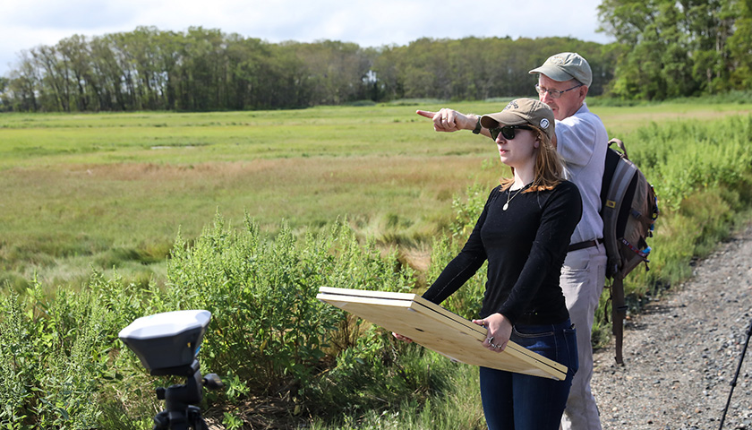
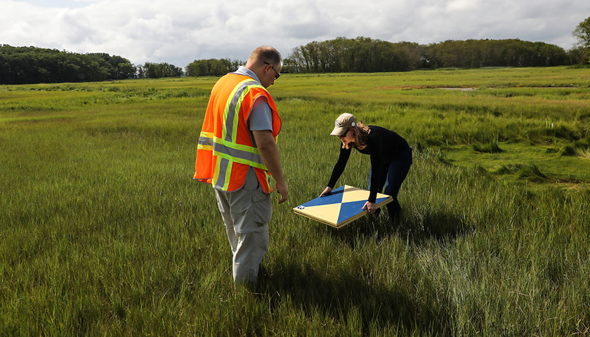
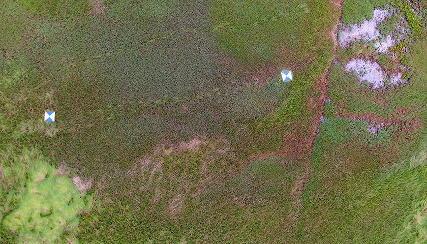
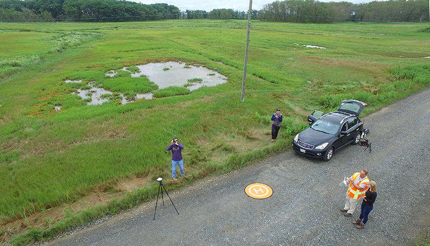
After offering insect repellent all around, Lussier takes out five blue-and-yellow ground control markers and asks to Teresa “Tedy” Feijoo, Class of 2019, to distribute them in the transect area.

Suffolk Experience: What's the Buzz
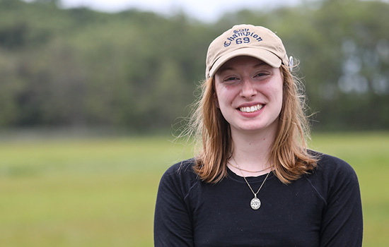
Feijoo, an Environmental Science student with an Art History minor, is just back from a summer internship at the Grand Canyon and has quickly segued into drone research. She is particularly interested in plants, and, as head of the student Environmental Club’s garden committee, manages a campus hydroponic garden tower.
Feijoo had become intrigued by drone applications in science while a student in Lussier’s digital mapping course, where she saw a film of drones collecting samples by flying through whales’ blowhole spray.
“I wanted to get drone experience,” said Feijoo, who sees familiarity with drones as helpful in the sorts of jobs that interest her. “If I want to go into forestry, for example, I can put a drone above the tree canopy and take pictures.”
Painstaking process
As Feijoo steps off the road into the marsh, Burn reassures her: “Don’t worry, you’re not going to sink.”
Despite a rainy couple of weeks preceding the site visit, the moisture lies below the blades of grass crunching underfoot. But this particular grass—Spartina patens, which lies in swirly “cowlicks” at the higher levels of the marsh and is harvested for salt marsh hay—cannot survive too many saltwater inundations. It is losing ground to other grasses—including Spartina alterniflora, a more upright species—that have evolved to better tolerate an increase in saltwater and related changes.
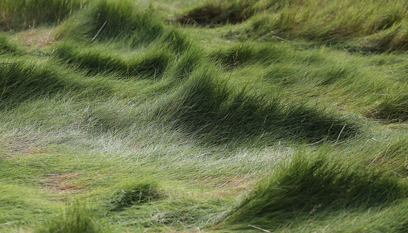
The drone can “see” the grass patterns and document how they change over time.
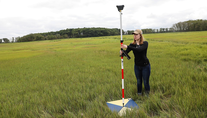
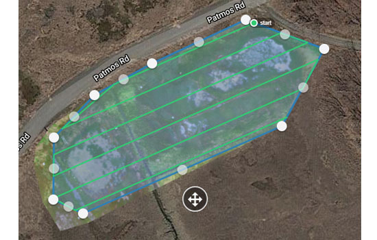
The markers Feijoo places on the marsh are part of a GPS setup that allows highly accurate geolocation for the drone flight, to within 10 to 20 centimeters. “Without it you could be five meters off,” says Lussier. He shows Feijoo a map from a June 8 drone flight. This late-August flight will cover the same track.
“The drones allow efficiency,” says Lussier. Whereas Mass. Audubon’s Buchsbaum has been painstakingly sampling the same transect by walking the tract regularly over the past five years, the drone can photograph the area in minutes.
“For him to come out takes a whole day,” says Burn. “This way the digital record lives in his computer.”
Mapping the flight
Next, Feijoo uses a GPS unit to mark the ground control markers’ locations. The GPS units used for the aerial survey “talk to each other” to create accurate data points.
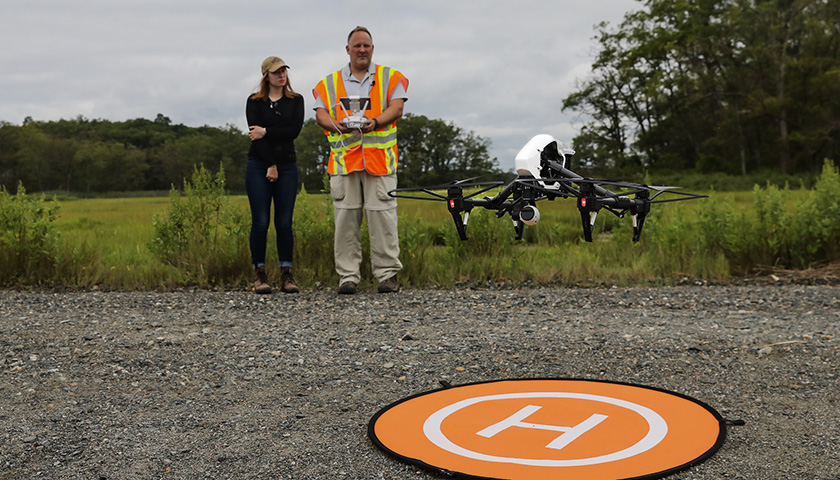
“We’ve got our points; we’re ready to fly now,” says Lussier, who attaches an iPad to the drone controller and places an orange target on the road for liftoff and landing.
Using a sophisticated mapping system, he has preprogrammed the drone to follow a track and take a sequence of 194 photos, which will be repeated each time the Suffolk team visits the marsh. Software will stitch together the images to map the marsh grasses. The scientists can then compare images from different dates and see how the marsh is changing.
“Mission-planning software tells the drone where to take pictures. It will go up and do the pattern,” says Lussier. The altitude is set for 66 feet.
A pickup truck pulls up, and its occupants ask what’s going on, stay and watch for a few minutes, and then move on.
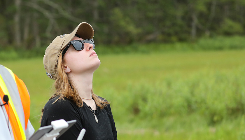
Feijoo is assigned the task of monitoring the sky for helicopters and, hawks.
“We don’t want to hurt them,” says Lussier. “And we don’t want to hit trees or pylons” supporting nearby transmission lines.
The launch
Lussier yells “clear.” There’s a whirring sound. “Sounds good so far,” he says. The whirring intensifies, and the drone is aloft. Using a controller that would feel familiar to a gamer, Lussier gives the drone a little wiggle. “Everything sounds fine.”
The drone traverses a straight line—indicated by one of a set of blue parallel lines in an iPad in Lussier’s hands. It then turns quickly to trace a parallel path in the air—over and over again. The drone has a lock on 19 satellites “so it knows where it is in the sky,” says Lussier.
As a licensed pilot, Lussier can allow Feijoo to fly the drone as long as he maintains supervisory control. He offers her the controls, and she begins to pilot the drone.
It’s not just the piloting that excites Feijoo, but also learning the detailed process that goes into planning and executing a drone research expedition.
“I thought it was an awesome experience, and I’m glad I jumped on it,” she said. “I never did anything like putting the panels on the salt marsh, let alone walk on a salt marsh.”
Feijoo’s goal after graduation is to land an outdoors job, and Lussier is helping her network, connecting her to a researcher working on another drone vegetation project.
The pickup comes back along the road, and the driver pulls out a smartphone to shoot video of the drone flight through his windshield.

Accelerated change
Plum Island, anchored to a drumlin, hasn’t moved geologically in 7,000 years. As the glaciers retreated, the rising seas flooded the land behind the barrier island, according to Burn. The rate of sea level increase eventually slowed, to 0.6 millimeters per year, which allowed for gradual buildup of the marsh through sediment deposits.
However, the seas around Plum Island are now rising more than 5 millimeters per year, a rate not seen for more than 10,000 years. Turning to Feijoo, Burn says: “It will be about five feet in your lifetime.”
Research to help researchers
Not only is the Suffolk team intent on the study at hand, but it also is researching how best to use the drone in marshland research.
“At this point we don’t know how high to fly the drone to ID the grasses,” says Burn, noting that a low-altitude flight offers rich detail, but a drone flying higher can cover the same ground in less time. “Can we ID them from 50 feet or 100 feet?”
You can’t see the stress from the air,” he adds, so the drone data are supplemented by Buchsbaum’s work at the ground-level, inspecting the vegetation and terrain as he walks the same lines flown by the drone. The study also will evaluate cameras and other equipment.
Once their questions are sorted out, Burn and Buchsbaum will prepare a scientific paper for the New England Estuarine Research Society on drone use in salt marsh studies.
“There’s so much potential,” says Lussier. In experimenting with how best to use the drone for salt marsh research, “we’re trying to help the Audubon scientists. Ultimately my goal is to set them up so they can do their own drone studies.”
Suffolk scientists are collaborating in a climate change study at the Massachusetts Audubon sanctuary in Rowley.
Buchsbaum joins the group. Today’s planned survey is complete, but the scientists decide to stay a bit longer to focus on some invasive grasses that have gained a foothold on the edge of the marsh.
Burn points out the so-called high-tide bush growing along the roadside and predicts that, in time, it may be the only vegetation remaining.
“If Teddy were to come back in in 20 years, I would expect the salt marsh as we know it to be gone,” he says. “That’s why this is so important.”
Contact
Greg Gatlin
Office of Public Affairs
617-573-8428